Northwest Oklahoma’s Black Mesa is not on the way to anywhere but well worth the trip

By Christopher Rush
The state of Oklahoma is not generally known for its mountain vistas, but a hidden gem tucked away in the extreme northwest corner of the Panhandle provides a top-rated hiking experience, a near-pristine southwestern landscape and some beautiful views to boot.
Black Mesa, the highest elevation point in Oklahoma, is an ancient plateau rising to a surprising height of 4,973 feet above sea level and several hundred feet above the surrounding valley floor.
Located in the tri-state area bordering New Mexico and Colorado, Black Mesa is remote and not on the way to anywhere. It’s one reason it took the author 59 years to finally make the trek, but it was well worth the time and effort.
Not to be confused with adjacent Black Mesa State Park just a few miles to the south, the Black Mesa Nature Preserve was initially acquired by The Nature Conservancy, a global environmental nonprofit dedicated to conserving lands and waters deemed critical to wildlife and biodiversity. In 1991, TNC conveyed the property, including approximately 60 percent of the vast mesa top, to the Oklahoma Tourism and Recreation Department with restrictions regarding development and other use.
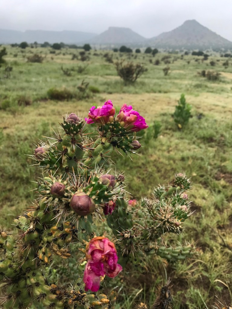
The mesa takes its name from a thick layer of black volcanic rock that covered the area approximately 30 million years ago. According to TNC, the area “supports 31 state rare species; 23 plants and eight animals. Here, the Rocky Mountains meet the shortgrass prairie, a unique area where many species are at the easternmost or westernmost portions of their range.”
Indeed, from the lowland portion of the trail as well as atop the mesa, hikers will likely see multiple bird species and a unique variety of semi-arid plant life. Once at the top, hikers can also view the foothills of the Rocky Mountains in New Mexico immediately to the west and Colorado just a few miles to the north.
The trail itself is 8.5 miles out-and-back with 734 feet in elevation gain, and is lightly trafficked. It is rated “moderate” by AllTrails.com (https://www.alltrails.com/trail/us/oklahoma/black-mesa). The trail is accessible from dawn to dusk year-round.
To get there from the tiny town of Kenton, Okla,, head east on Highway 325 for half a mile, then turn left (north) on a county road for another five miles. Road signage helps point the way. The parking lot for the trailhead and the nature preserve will be on the left.
The trail itself is 8.5 miles out-and-back with 734 feet in elevation gain, and is lightly trafficked. It is rated “moderate” by AllTrails.com (https://www.alltrails.com/trail/us/oklahoma/black-mesa). The trail is accessible from dawn to dusk year-round. Dogs are permitted but must be kept on leash.
Summer temperatures in the Oklahoma Panhandle can be brutal at midday — typically in the high 90s or 100 degrees plus — but due to an unusual weather pattern of unseasonably cool temperatures accompanied by almost daily rainfall, we found ourselves in nearly ideal conditions for late June. More typically, hikers should plan on early morning treks during the summer months to avoid extreme heat.
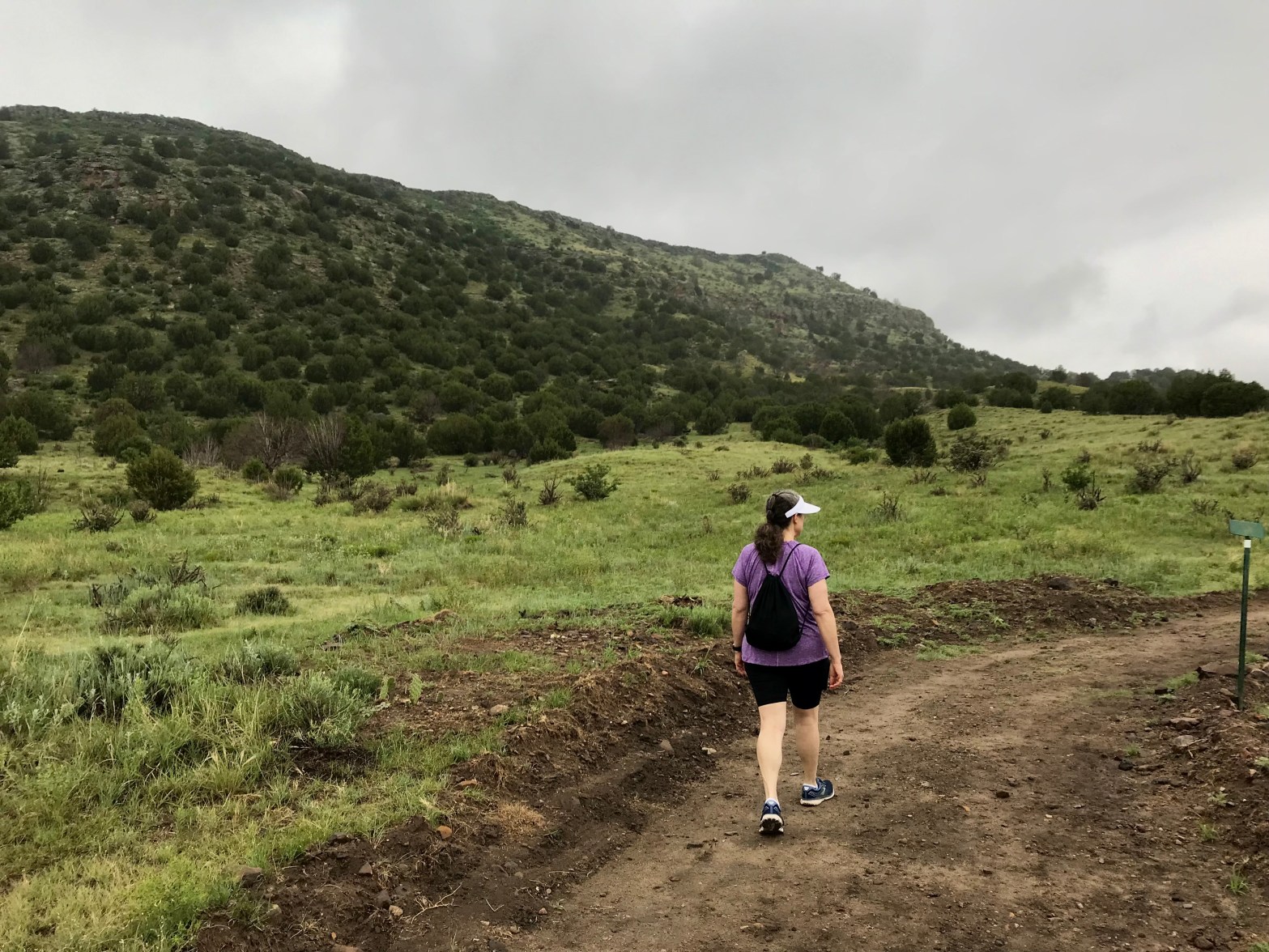
On this day, the temperature hovered in the mid 60s with light mist and fog as we arrived at the trailhead at 10 am. After loading our day packs with plenty of water and a lunch we set out at a brisk pace — or at least what we considered brisk for a couple in their late 50s. Another younger couple ahead of us used trekking poles and set a blazing pace. We opted for slow and steady by comparison.
The well-groomed and well-marked trail initially skirts the base of the mesa through short grasses, juniper and cedar trees, and several species of semi-arid succulents, many of which were in bloom due to the recent rainfall. Mile markers and an occasional bench are located at points along the trail. Beginning with mile three, the trail begins a steep ascent through a series of switchbacks up the side of the forrested mesa wall.
Once atop the plateau, the trail opens up into high plains ecosystem of short grasses and semi-arid plants. Another mile or so of flatland hiking brings the hiker to a marble obelisk placed by the state of Oklahoma to mark the exact point of highest elevation as determined by the U.S. Geological Survey. A weather-tight metal box at the base of the monument contains some emergency first aid and a journal to sign by hikers.

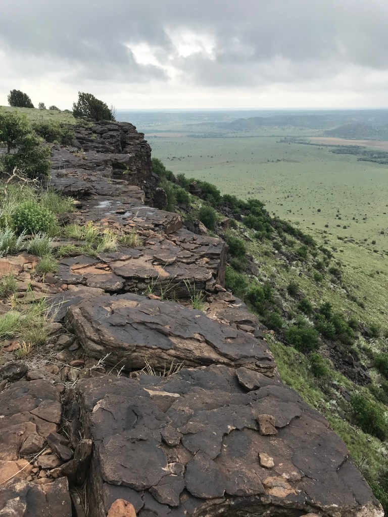
Another quarter mile or so on a lightly traveled trail will lead hikers to the precipice of the mesa’s western edge overlooking the valley below. It is here that the i-phone camera comes in handy for recording the picturesque scene above and below. Here, there is no traffic noise, just the sound of the breeze and the song of the meadowlark. It’s an excellent spot to eat a meal, rest a bit and reflect on the power of nature and the surrounding geology.
By noon the sun had finally broken through the clouds and would eventually warm the air to the low 80s. It was at this moment I wish I had listened to my wife and applied sunscreen.
All told, the round-trip hike took these aging boomers nearly five hours with picnic lunch at the top and multiple water breaks along the way included. Young whippersnappers can expect a minimum of 2.5 hours on the trail at a very brisk pace, but 3 hours is more realistic. And besides, what’s the hurry?
All told, the round-trip hike took these aging boomers nearly five hours with picnic lunch at the top and multiple water breaks along the way included. Young whippersnappers can expect a minimum of 2.5 hours on the trail at a very brisk pace, but 3 hours is more realistic. And besides, what’s the hurry?
It should be noted, that whatever direction you are traveling from to visit Black Mesa, be advised that there are no services nearby – no gas stations, no restaurants, and spotty cellular reception at best. Come prepared with a full tank of gas, plenty of drinking water, snacks, sunscreen, and appropriate clothing for sudden changes in the weather.
This same lack of nearby civilization is what makes the region a coveted outdoor experience. For skywatchers, nearby Black Mesa State Park (about 15 miles southeast of the preserve) boasts some of the darkest nighttime skies on publicly accessible land in the nation. These dark skies, far from urban light pollution, draw countless astronomy enthusiasts to the area.
Black Mesa State Park is adjacent to Lake Carl Etling and offers online reservable RV campsites with water and electric hookups, tent campsites, picnic facilities, and more. For more information, logon at (https://www.travelok.com/state-parks/black-mesa-state-park-nature-preserve?adara_campaignid=194193234&adarapixelid=76743&gclid=CjwKCAjw87SHBhBiEiwAukSeUbNqu2fINE8vUevjtqQhkmqYZnOfBmGWh_6YkdOI4iouL_ReqHP__hoCj8wQAvD_BwE
